

hhypiresia
The Directorate for Electronic Navigational Charts organizes, manages and updates the Cartographic Database of HS's Marine Geographic Information System. As part of its activities, the Directorate for Electronic Navigational Charts draws up, updates and makes available:
- Electronic Navigational Charts (ENCs)
- Printed Navigational Charts using digital methods
- Additional Military Layers (AMLs)
- Thematic Charts
- Digital Nautilus Charts smartphones and tablets
- The Web Map Service
- Marine Geospatial Data
ENCs are VECTOR maps in S-57 format in line with the specifications of the International Hydrographic Organization (IHO). These charts are suitable for Electronic Chart Display Information Systems (ECDISs) and available in IHOS-63 encryption. Greek ENCs can also be used by any system that can read S-63 encrypted S57 data structure.

Since April 2004, the HS has began offering Greek ENCs, as well as the monthly constant Updating Service via the Regional Coordinating Center for IC-ENC Chart Distribution.
Anybody interested in information on the availability, as well as on the conditions that apply to and the way of obtaining Greek ENCs, can visit the IC-ENC website.
For further information or clarifications on issues related to the activities of the Directorate for Electronic Navigational Charts, please call +30 2106551830 and +30 2106551759, or email us at dcd_hnhs@navy.mil.gr

A. Hydrographic Measurements
Hydrography is the branch of earth sciences dealing with measuring, describing, and mapping characteristics (natural and artificial) of the relief of the seabed and the surrounding coastal areas.
Investing in Hydrography improves safety at sea, enhances the protection of the marine environment and promotes national growth. This means more efficient and safe maritime transport, leading to the strengthening of global and coastal trade. In addition, it contributes to the development of national infrastructure, coastal zone management, promoting marine research, exploiting marine resources (minerals, fishing, etc.), delimiting maritime borders, sea defense and security, and managing coastal disasters.
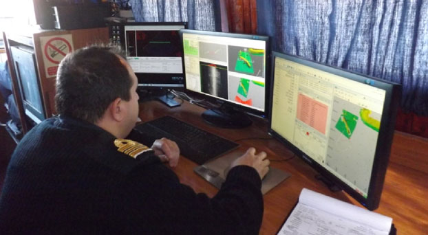
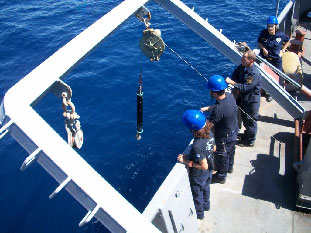
To that end, special vessels are used aboard which is installed the necessary scientific equipment for measuring depth and position, seabed survey, as well as computers with appropriate software for data collection and processing. All works are performed by suitably qualified scientific staff.
It has been established that almost every human activity performed in, on or under the sea requires some knowledge of the hydrography of the area concerned, that is, knowledge of the shape and nature of the bottom, its characteristics and risks. It, therefore, becomes evident that hydrography is necessary for:
- the safe sailing of ships;
- building ports;
- developing coastal infrastructure;
- implementing marine environment projects;
- protecting coasts and islands;
- performing sea rescue operations;
- developing flood models;
- delimiting or respecting maritime borders.
Accordingly, insufficient hydrography means: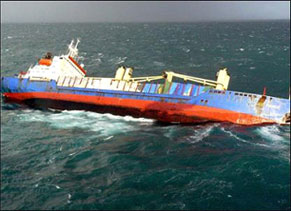
- increased risk of maritime accidents, resulting in loss of life and environmental pollution;
- lack of trust in sea routes and ports, leading to a drop in international trade and wasted economic opportunities;
- environmental impacts;
- possible litigation and legal responsibilities.
Let us consider the cost of:
- underdeveloped ports;
- complex and dangerous sea routes;
- the lack of fundamental design elements for coasts and seas;
- limited area of operations of patrol vessels and warships.
Studies in this area have shown that the cost-benefit ratio is greater than 1:10!
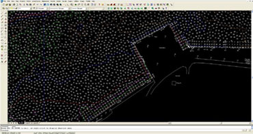
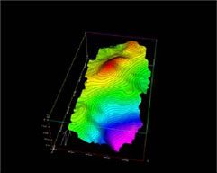
The important work of hydrography has been undertaken by the Division for Hydrography-Operations of the HNHS. It is its core mandate to plan, design and conduct Hydrographic, Geodetic and Topographic fieldwork. Data collected are processed to draw up relevant studies and charts, which are then forwarded to the competent directorates and serve to update navigational charts and nautical publications and disseminate maritime information to end users.
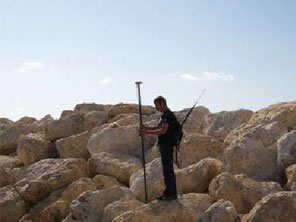
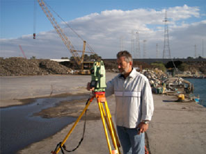
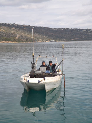
Fieldwork is carried out by Hydrographic Crews made up of qualified scientific, technical military and civilian staff, onboard the vessels available, conducting the necessary geodetic and topographic works.
All works and data processing are performed pursuant to the technical specifications laid down by national legislation and the technical instructions of the International Hydrographic Organization (IHO). Such specifications have been incorporated in the standing Hydrographic Instructions given to the Hydrographic Crews.
To carry out these works in accordance with the prescribed requirements, the Division has installed suitable equipment aboard its vessels and at its facilities, consisting of:
- Precise positioning systems (Global Navigation Satellite Systems);
- Multi-beam echo-sounders;
- Single-beam echo-sounders;
- Sound velocity profilers;
- Side scan sonars;
- Data collection and processing software;
- Surveying instruments;
- Network of permanent tide gauges;
- Underwater cameras.
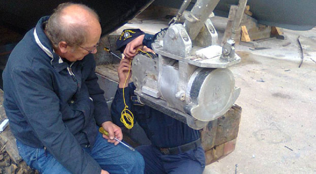
Appropriately qualified technical staff are responsible for repairing and maintaining those instruments to ensure their proper functioning and extend their useful life.
All information obtained from the processing of data, besides being made available to other directorates of the HNHS to produce and update its end products, are kept in printed and electronic format in the Directorate's records for future use.
The Division's staff is also involved in joint surveys with other countries hydrographic offices as part of international agreements and programs in which the HNHS is involved.
In addition to the above, drawing on its expertise and experience, the Division cooperates with other government agencies, such as ministries, regional governments, municipalities, port organizations and authorities. There is particular cooperation with other geographic and scientific agencies, such as the Hellenic Military Geographical Service (HMGS), the Greek Center for Marine Research (HCMR), National Cadastre & Mapping Agency SA (NCMA SA), as well as higher education institutions such as the National Technical University of Athens (NTUA) and the University of the Aegean.
B. Oceanography
Being knowledgeable of the marine environment and how it behaves, plays an important part in the conduct of naval operations. The Hydrographic Service is in charge of planning and conducting oceanographic research to study and find out about the physical parameters and natural phenomena of the marine environment, to the benefit of the HN. It is a set of scientific works, known as Military Oceanography, implementing operational oceanography, with a view to supporting the units of our fleet. Oceanography Directorate is in charge of such tasks.
The instruments used include:
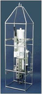
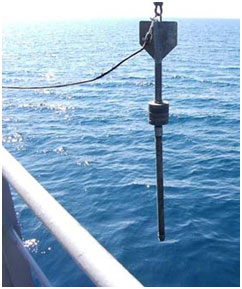
CTD instrument packages
Conductivity, Temperature, Depth (CTD) instruments are used to determine the main physical parameters of the water and the speed of sound propagation in it.
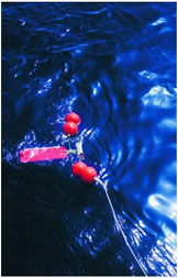
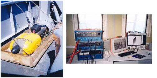
Current Meters
Mechanical and acoustic current meters are used to measure the speed and direction of currents in different regions of the Aegean and Ionian Seas at selected depths.
At the same time wave conditions prevailing in Greece’s maritime space are assessed. These forecasts are intended for use by the Ministry of Merchant Marine for the departure of certain passenger ships. They result from the use of mathematical models to estimate the wave field taking into account the speed and direction of winds in the area of interest.
The Directorate also collects bathythermographic and other observations from other ships and services of the HN. These are processed, sorted and used accordingly.
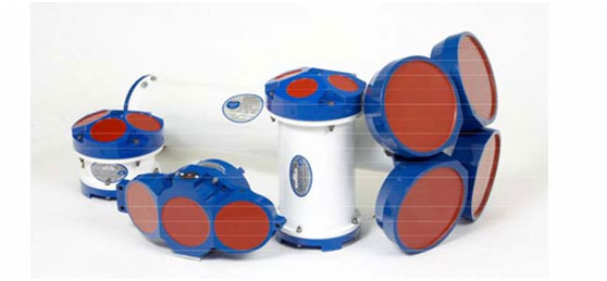 Different Type Acoustic Current Meter
(Side Scan Sonar)

Type 'Chirp' Sub-bottom Profiler
It determines the stratigraphy of the seabed structure to a depth of several meters, depending on the particle size distribution of sediments in the area studied.
 Surface Sediment Samples
It takes disturbed samples of surface sediment. Such samples are analyzed in the laboratory to sort sediments based on their particle size distribution and determine the content of carbonates in them.
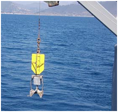
Gravity Core Sampler
It takes samples of bottom sediment cores. The undisturbed samples taken are analyzed in the laboratory to sort sediments based on their particle size distribution across the entire sampling length, as well as to determine the percentage of carbonates, the density and shear strength of core sediments.
The Hellenic Navy Hydrographic Service (HNHS) is the official hydrographic organization of Greece. It is an independent agency of the Hellenic Navy (HN), based in Attica and accountable directly to the Chief of the Hellenic Navy General Staff. It has its own seal and emblem, which are used in all its publications.
HNHS personnell represents the country at the International Hydrographic Organization (IHO), participating in its conferences, committees and working groups, as well as participates in various international civilian and military organizations, on matters related to its work and mission.
Mission
The purpose of HNHS is to study the Greek and the adjacent seas, coasts and ocean, the navigation conditions, to contribute to the development and the promotion of the sciences and arts related to navigation, hydrography, oceanography, shipping and maritime meteorology.
The mission of the HNHS includes, among other things, the composition and production of nautical charts and publications, as well as the creation of products that result from studying the parameters of the marine environment, the development of geosciences (hydrography, topography, oceanography, geography) and the science of navigation.
More specifically, the HNHS collects, processes and uses information and data to generate products and services related to Hydrography, Naval Cartography, Marine and Military Oceanography in order to:
- support and meet the operational requirements of the HN and National Defense, in general, on matters that fall under its competence;
- contribute to the safety of seafarers in Greek and neighboring seas;
- protect the marine environment;
- contribute to the growth of the economy of the country's islands;
- assist and support, where required, public services, legal and natural persons, and private entities in their work.
The Hellenic Navy Hydrographic Service is a government agency that has exclusive competence and certification to draw up, publish, supplement and correct the official navigational charts of Greece and their updates, as well as to publish, supplement and correct official nautical publications.
Moreover, the HNHS publishes in printed and/or electronic format, navigational aids and instructions, notices, messages and announcements, wave forecasts and oceanographic information, contributing to the promotion and development of shipping and navigation safety.
Lastly, the HNHS is the National Coordinator for the management and operation of NAVTEX Service, in accordance with national and international law and practice.
The GeoIndex is an interactive tool designed to assist the HNHS’s website visitor in the identification of cartographic products of interest. The GeoIndex employs a cartographic background and the basic tools for Navigation; Zoom In; Route Tracing; etc.
The above tools are used to query the Geoindex, select the cartographic products of interest and add them to the shopping basket.
Detailed user’s guidance is provided by clicking the “Help” button.
Go to GEOINDEX
Προαγγελίες για τους ναυτιλλόμενους (Hellenic Navwarns)
Η Υδρογραφική Υπηρεσία εκτός από τις αγγελίες για τους ναυτιλλόμενους, εκδίδει και επείγουσες πληροφορίες με τον τίτλο "Προαγγελίες για τους Ναυτιλλόμενους" (HELLENIC NAVWARNS), οι οποίες αφορούν σε πληροφορίες για την ασφάλεια της ναυσιπλοΐας.
Για το κύριο θέμα των προαγγελιών βλέπε παράγραφο 7.1 της Ετήσιας Αγγελίας υπ’ αριθμ. 13.
Οι προαγγελίες δεν αντικαθιστούν τις αγγελίες που εκδίδονται από την ΥΥ ή άλλα ναυτιλιακά βοηθήματα.
Οι προαγγελίες αριθμούνται για τη διάρκεια κάθε έτους κατά αύξοντα αριθμό από το 1 και ο αριθμός αυτός συνοδεύεται από το έτος εκδόσεώς τους (π.χ. 1073/ 1999).
Οι προαγγελίες καταργούνται:
- Αυτόματα (όταν έχουν καθορισμένη διάρκεια)
- Με άλλη προαγγελία.
- Με σχετική αγγελία (στην οποία περιλαμβάνεται πληρέστερα και εκτενέστερα η αρχική πληροφορία που δόθηκε με την προαγγελία) οπότε η προαγγελία εξακολουθεί να μεταδίδεται για 15 ημέρες, από την έκδοση της αγγελίας που την καταργεί, γιατί εκτιμάται ότι μέσα σε αυτό το χρονικό διάστημα θα έχει ολοκληρωθεί η διασπορά της αγγελίας. Η κατάργηση της προαγγελίας μετά το 15νθήμερο γνωστοποιείται στους ναυτιλλόμενους με άλλη προαγγελία.
Οι προαγγελίες δεν εκτυπώνονται και δεν διανέμονται όπως οι αγγελίες, αλλά, λόγω του επείγοντος, μεταδίδονται με Ραδιοτηλεφωνία ως εξής:
- Τύπος εκπομπής J3E στην Ελληνική και Αγγλική γλώσσα από τους κατωτέρω παράκτιους σταθμούς κατά περιοχές ως εξής:
ΚERKYRA RADIO" (39˚ 36΄ 25,7΄΄- 19˚ 53΄28,4΄΄) για το Ιόνιο Πέλαγος μέχρι τον μεσημβρινό 22° 30΄ 00" προς ανατολάς (περιλαμβανομένου του Πατραϊκού και Κορινθιακού κόλπου).
"IRAKLEIO RADIΟ" (35˚ 19΄ 19,7΄΄- 25˚ 44΄ 54,9΄΄) και "LIMNOS RADIO" (39˚ 54΄ 24,7΄΄- 25˚ 10΄ 50,6΄΄) για το Αιγαίο Πέλαγος μεταξύ των παραλλήλων : 34° 00΄ 00" - 41° 00΄ 00" και των μεσημβρινών 22° 30΄ 00" - 30° 00΄ 00".
"RODOS RADIO" (36˚ 24΄ 31,2΄΄- 28˚ 13΄ 37,1΄΄) για το Νότιο Αιγαίο Πέλαγος μεταξύ των παραλλήλων: 34° 00΄ 00" - 38° 00΄ 00" των μεσημβρινών : 22° 30΄ 00" - 30° 00΄ 00"
Οι παράκτιοι σταθμοί ΚERKYRA RADIO και LIMNOS RADIO μεταδίδουν και τον περιληπτικό πίνακα των προαγγελιών που ισχύουν για ολόκληρο τον Ελληνικό θαλάσσιο χώρο.
Σημείωση : Το χαρακτηριστικό κλήσεως, η συχνότητα, οι ώρες και ο τύπος εκπομπής και λοιπά στοιχεία των ανωτέρω σταθμών καθώς και πληροφορίες που αφορούν στη μετάδοση "Μετεωρολογικού Δελτίου" και "Δελτίου Τύπου " παρέχονται με λεπτομέρειες στον πίνακα συχνοτήτων που επισυνάπτεται στο τέλος του τεύχους. - Τύπος εκπομπής G2B / G3E, στην Ελληνική και Αγγλική γλώσσα για ολόκληρο τον Ελληνικό Θαλάσσιο χώρο, από τους κατωτέρω αναμεταδότες VHF του Σταθμού Εκπομπής
"OLYMPIA RADIO"
| ΑΝΑΜΕΤΑΔΟΤΗΣ | ΘΕΣΗ | Δίαυλος Εκπομπής | Ισχύς (WATT) |
ΠΡΟΑΓ. Ώρες Εκπομπής σε UTC |
ΜΕΤΕΩΡ/ΚΟ ΔΕΛΤΙΟ Ώρες Εκπομπής σε UTC |
| ΚΕΡΚΥΡΑΣ | 39 44 54 - 019 52 20 | 02 | 50 |
Για την περιοχή Ανατολικής Μεσογείου και Μαύρης Θάλασσας |
|
| ΚΕΦΑΛΛΗΝΙΑΣ | 38 08 28 - 020 39 31 | 27 | 50 | ||
| ΠΑΤΡΑΣ | 38 14 47 – 21 46 07 | 85 | 12 | OXI | |
| ΠΕΤΑΛΙΔΙΟΥ | 36 55 45 - 021 51 32 | 83 | 50 | ||
| ΚΥΘΗΡΩΝ | 36 15 57 – 023 02 50 | 85 | 50 | ||
|
ΜΟΥΣΤΑΚΟΥ (ν. Κρήτη) |
35 18 28 - 023 36 35 | 04 | 50 | OXI | |
|
ΚΝΩΣΣΟΥ (ν. Κρήτη) |
35 16 52 - 024 56 08 | 83 | 50 | 05: 00 | 06:00 |
|
ΣΗΤΕΙΑΣ (ν. Κρήτη) |
35 04 14 - 026 11 32 | 85 | 50 | 11: 00 | 10:00 |
| ΡΟΔΟΥ | 36 16 22 - 027 56 01 | 63 | 50 | 17: 30 | 16:00 |
| ΣΥΡΟΥ | 37 27 27 - 024 55 37 | 04 | 25 | 23: 30 | 22:00 |
| ΠΑΡΝΗΘΑΣ | 38 10 16 - 023 43 39 | 25 | 50 | ||
| ΠΗΛΙΟΥ | 39 24 16 – 023 03 07 | 60 | 50 | ||
| ΧΙΟΥ | 38 22 34 - 026 02 44 | 85 | 50 | ΟΧΙ | |
| ΜΥΤΙΛΗΝΗΣ | 39 04 22 - 026 21 15 | 01 | 50 | ||
| ΛΗΜΝΟΥ | 39 54 14 - 025 04 39 | 82 | 50 | ||
|
ΣΦΕΝΔΑΜΗΣ (Πιερία) |
40 25 09 - 022 31 06 | 23 | 50 | ||
| ΑΣΤΥΠΑΛΑΙΑΣ | 36 35 59 – 026 26 26 | 23 | 50 | ΟΧΙ | |
| ΘΑΣΟΥ | 40 43 51 – 024 39 43 | 85 | 50 | ||
| ΦΑΙΣΤΟΥ | 34 59 37 – 025 12 25 | 27 | 50 |
Σημείωση :
α. Οι ανωτέρω εκπομπές προαναγγέλλονται στο δίαυλο ανταπόκρισης κινδύνου 16 για τα VHF και με κλήση DSC (SAFETY) στη συχνότητα 2187,5 για τα MF.
β. Εάν εκδοθούν προαγγελίες που απαιτείται η έκτακτη μετάδοσή τους, τότε μεταβιβάζονται από τα κανάλια εργασίας των περιοχών που τις αφορούν, πρώτα με ψηφιακή επιλογή κλήση (DSC) στο δίαυλο 70, ακολουθούμενη με προαναγγελία στο δίαυλο ανταπόκρισης κινδύνου 16 για VHF και με κλήση στο DSC στη συχνότητα 2187,5 kHz για τα MF.
Οι σταθμοί της ανωτέρω παραγράφου μεταδίδουν καθημερινά, κατά τις πιο πάνω ώρες, στην Ελληνική και Αγγλική γλώσσα τις αριθμημένες προαγγελίες για τους ναυτιλλόμενους (HELLENIC NAVWARNS) καθώς και “πίνακα προαγγελιών που ισχύουν”, ο οποίος εκδίδεται καθημερινά από την ΥΥ. Επίσης οι ανωτέρω σταθμοί λαμβάνουν και αναμεταδίδουν πληροφορίες πλοίων σχετικές με την Ασφάλεια της Ναυσιπλοΐας.
Το πλήρες κείμενο μιας προαγγελίας που δεν μεταδίδεται, η περίληψη όμως της οποίας περιλαμβάνεται στον “πίνακα των προαγγελιών που ισχύουν”, μπορεί να ζητηθεί από τους σταθμούς που προαναφέρθηκαν από κάθε ενδιαφερόμενο ναυτιλλόμενο.
Οι κατά τόπους λιμενικές αρχές, παρέχουν κατά τη χορήγηση αδείας απόπλου (CLEARANCE), τον τελευταίο “πίνακα των προαγγελιών που ισχύουν”, στον οποίο αναγράφεται ο αριθμός κάθε προαγγελίας που ισχύει, το θέμα της και η περιοχή στην οποία αναφέρεται (περιληπτικά), ώστε ο Πλοίαρχος αμέσως μετά τον απόπλου να μπορεί να ζητήσει με Ρ/Τ από τους παράκτιους σταθμούς το πλήρες κείμενο της προαγγελίας εκείνης που ενδιαφέρει τον πλου του.
Σε περίπτωση που η ΥΥ κρίνει αναγκαία την ευρύτερη διασπορά μιας "Προαγγελίας" τη διαβιβάζει ως NAVHELLEN στον συντονιστή NAVAREAIII (ΙΣΠΑΝΙΑ), που έχει καθοριστεί ως υπεύθυνος της διασποράς των προαγγελιών για την περιοχή Μεσογείου - Μαύρης Θάλασσας.
Λεπτομερείς πληροφορίες για τις περιοχές και τους συντονιστές τους, τους σταθμούς, τις συχνότητες και τις ώρες εκπομπής των NAVAREA προαγγελιών, παρέχονται στην αγγελία αριθμός 13 κάθε έτους καθώς και στο ADMIRALTY LIST OF RADIO SIGNALS ΝΡ 283(1) του Βρετανικού Ναυαρχείου.
Για τις εν ισχύει Προαγγελίες, πατήστε εδώ
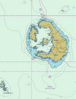
Με στόχο την ασφάλεια της ναυσιπλοΐας και την προστασία του θαλάσσιου περιβάλλοντος η Υδρογραφική Υπηρεσία έχει τη δυνατότητα εκπόνησης μελετών, γνωματεύσεων και γνωμοδοτήσεων επί ναυτιλιακών θεμάτων για λογαριασμό τρίτων, όπως η σήμανση λιμένων, οι ναυτιλιακοί κίνδυνοι, (π.χ. ναυάγια, αβαθή), ο καθορισμός διαύλων κ.α..
Η διαδικασία μπορεί να περιλαμβάνει, εφόσον αυτό απαιτείται, επιτόπια αυτοψία από ειδικευμένο στα θέματα αυτά προσωπικό της ΥΥ.
Οι υπηρεσίες παρέχονται μετά από αίτηση του ενδιαφερόμενου φορέα προς την ΥΥ, προκειμένου η Υπηρεσία να εξετάσει, να αξιολογήσει, να σχεδιάσει και να προγραμματίσει την εκτέλεση της εργασίας. Για την εκτέλεση της εργασίας απαιτείται η προηγούμενη σύναψη σχετικής συμφωνίας μεταξύ των δύο μερών.


