
hhypiresia
Aiming at the safety of navigation and the protection of sea environment, HNHS has the Capacity of conducting studies, reports and opinions upon navigational subjects on the account of third parties, such as ports signage, navigational hazards, (i.e. shipwrecks, shallow waters), channel determination etc.
The procedure may include, if required, on the spot inspection by specialized, in these issues, HNHS personnel.
The service are provided at the interesting party’ s request to HNHS, in order for the Service to examine, evaluate, plan and program work execution. For the work execution, a conclusion of a relative agreement is required previously between the two parties.
The printed Navigational Charts and Nautical Publications of the Hydrographic Service are available at:
a. E-Shop
b. The Piraeus shop
(66 Moutsopoulou Coast, Piraeus,
Tel-FAX: +30 210-4583632,
E-Mail:pr_store@hnhs.gr)
View Map
The Division studies, proposes and implements modern IT solutions aiming to fully automate the procedures for producing and offering HS products in line with the evolving trends in Telecommunications and IT.
In this context, it supports and manages, at both software and hardware levels, computer networks that:
 Are used to transfer data.
- Ensure resource sharing.
- Interconnect the points of sale of HS products.
- Distinguish the work and services that the HS offers to citizens over the Web.
- And support uninterrupted contact with the agencies, both in Greece and abroad, with which the HS works.

The Division is responsible for:
- Issues concerning ths HNHS personnel.
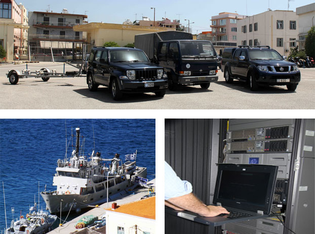
- Maintaining good operational condition of the hydrographic / oceanographic vessels and vehicles.
- Monitoring and managing financial cash transactions.
- Keeping up with the annual budget.
- Advertising HNHS products.
- Checking copyright issues.
- Maintaining and upgrading the local computer equipment
The Maritime Safety Division has the important mission of informing seafarers about and protecting them from the dangers lurking when sailing in the Eastern Mediterranean region.
The main activities of the Directorate are to:
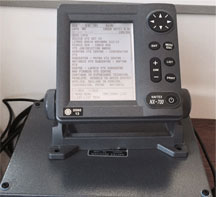
- Constantly inform seafarers by transmitting special navigational warnings and NAVTEX messages via the NAVTEX Service and navigational warnings to seafarers in cooperation with the Coast Guard, the National Meteorological Service, and the Hellenic Telecommunications Organization as part of the Global Maritime Distress and Safety System (GMDSS).
- Publish nautical publications (Monthly and Annual issue of Notices).
- Determine sea routes, channels, straits and natural harbors.
- Conduct maritime design for the installation by the Lighthouse Department and other agencies, of lighthouses, beacons, buoys, etc.
- Keep records of wrecks, dirty seabed and buoys for Greece’s maritime space.
- To represent the country at the International Maritime Organization and the International Hydrographic Organization, on matters related to its remit.
- Monitor and coordinate issues related to education, information and training of the HNHS staff
It is also actively involved in general and specific issues relating to the safety of navigation, such as:
- port or other technical projects to be constructed in seashore - beach areas and in the sea.
- unauthorized works built without permit or beyond the terms of an existing permit in the same area, and complaints about such illegal activities.
- concession - rental of marine areas to install and operate aquaculture units.
- concessions for use of seashore and beach areas, as well as terrestrial zones of ports.
- granting permits for sand extraction.
- installations of tanks for oil/oil derivatives in seashore - beach areas.
- drafting - updating of mile distances between Greek ports; calculating mileage as requested by various agencies and bodies.
- making proposals on matters relating to laying power (PPC) cables, telecommunications (OTE) cables and various pipes on shorelines.
- issuing opinions on the creation of waterways, determining operational areas for sea wind parks and diving centers.
- issuing opinions on the method of marking marine risks, channels and straits.
Being knowledgeable of the marine environment and how it behaves, plays an important part in the conduct of naval operations. The Hydrographic Service is in charge of planning and conducting oceanographic research to study and find out about the physical parameters and natural phenomena of the marine environment, to the benefit of the HN. It is a set of scientific works, known as Military Oceanography, implementing operational oceanography, with a view to supporting the units of our fleet. Oceanography Directorate is in charge of such tasks.
The instruments used include:
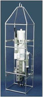
CTD instrument packages
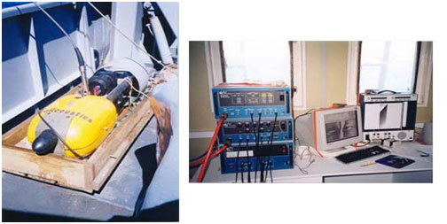
Conductivity, Temperature, Depth (CTD) instruments are used to determine the main physical parameters of the water and the speed of sound propagation in it.
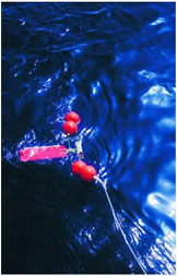
Current Meters
Mechanical and acoustic current meters are used to measure the speed and direction of currents in different regions of the Aegean and Ionian Seas at selected depths.
At the same time wave conditions prevailing in Greece’s maritime space are assessed. These forecasts are intended for use by the Ministry of Merchant Marine for the departure of certain passenger ships. They result from the use of mathematical models to estimate the wave field taking into account the speed and direction of winds in the area of interest.
The Directorate also collects bathythermographic and other observations from other ships and services of the HN. These are processed, sorted and used accordingly.
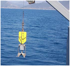
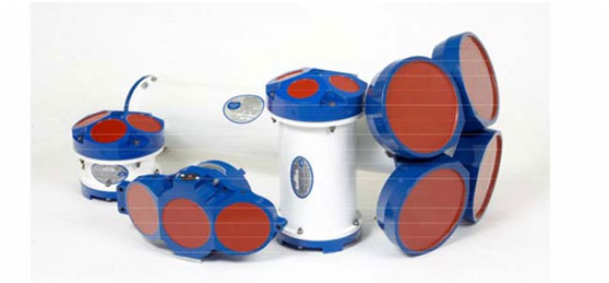 Differents Type Acoustic Current Meter
(Side Scan Sonar)

Type 'Chirp' Sub-bottom Profiler
It determines the stratigraphy of the seabed structure to a depth of several meters, depending on the particle size distribution of sediments in the area studied.
 Surface Sediment Samples
It takes disturbed samples of surface sediment. Such samples are analyzed in the laboratory to sort sediments based on their particle size distribution and determine the content of carbonates in them.
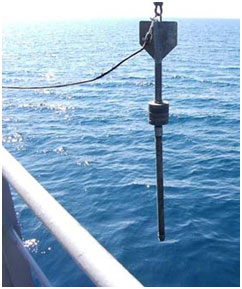
Gravity Core Sampler
It takes samples of bottom sediment cores. The undisturbed samples taken are analyzed in the laboratory to sort sediments based on their particle size distribution across the entire sampling length, as well as to determine the percentage of carbonates, the density and shear strength of core sediments.
It is the mission of the Cartography Directorate to:
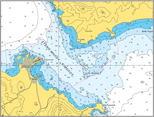
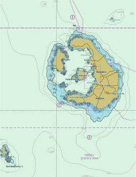
- Constantly update Greek Navigational Charts (GNCs) covering Greece’s maritime space, and drawn up using analog methods.
- Reprint GNCs to constantly meet stock needs.
- Reprint historical navigational charts of the HS.
- Study, design, draw up, publish and constantly update Special Navigational Charts and Graphs needed to meet the needs of the HN.
- Manage and offer Navigational Charts and Nautical Publications
- Work with international organizations to provide cartographic support to international programs on Greece’s maritime space.
For further information or clarifications on issues related to the activities of the Cartography Directorate, please call +30 2106551830 and +30 2106551754, or email us at carto_hnhs@navy.mil.gr
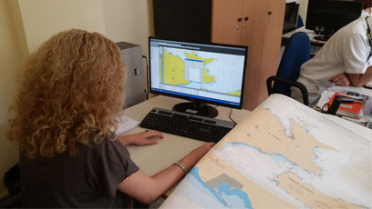
The Directorate for Electronic Navigational Charts organizes, manages and updates the Cartographic Database of HS's Marine Geographic Information System. As part of its activities, the Directorate for Electronic Navigational Charts draws up, updates and makes available:
- Electronic Navigational Charts (ENCs)
- Printed Navigational Charts using digital methods
- Additional Military Layers (AMLs)
- Thematic Charts
- Digital Nautilus Charts smartphones and tablets
- The Web Map Service
- Marine Geospatial Data
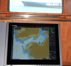
ENCs are VECTOR maps in S-57 format in line with the specifications of the International Hydrographic Organization (IHO). These charts are suitable for Electronic Chart Display Information Systems (ECDISs) and available in IHOS-63 encryption. Greek ENCs can also be used by any system that can read S-63 encrypted S57 data structure.

Since April 2004, the HS has began offering Greek ENCs, as well as the monthly constant Updating Service via the Regional Coordinating Center for IC-ENC Chart Distribution.
Anybody interested in information on the availability, as well as on the conditions that apply to and the way of obtaining Greek ENCs, can visit the IC-ENC website.
For further information or clarifications on issues related to the activities of the Directorate for Electronic Navigational Charts, please call +30 2106551830 and +30 2106551759, or email us at dcd_hnhs@navy.mil.gr


