

hhypiresia
KORINTHIAKOS GULF.LESS WATER AT THE ENTRANCE OF THE FISHING SHELTER AT KRYONERI AKRATAS AND PORT MAVRA LITHARIA.DANGER FOR NAVIGATION.
Copyright
The Hellenic Navy Hydrographic Service (HNHS) owns the rights over all hydrographic, enviromental and other geospatial data and information associated with the maritime space, which the Service has collected, processed and stored. This data & information includes the content of the HNHS products, like the Nautical Charts and Publications in analog and digital format.
Distribution and Use Policy
The HNHS can distribute its data, products and expertise to public and private entities, under specific agreement-partnership.
Offered Products and Services
Targeting to maximize the benefit for potential partners/ clients, the Hydrographic Service offers the following options:
- Resale License of the HNHS printed products (Nautical Charts & Publications)
- HNHS printed products (Nautical Charts & Publications) content Usage License (for the purpose of creating derived products for non-SOLAS vessels)
- HNHS Digital Products (S-57ed.3.1.1 files, electronic nagivation system files, other cartographic entities in shape file format, etc) Usage Licence (for the purpose of creating derived products-non SOLAS vessels)
- Upon request, to conduct Hydrographic and Safety of Navigation Field Surveys and Studies
- Upon request, HNHS data provision (sounding charts, sea level information, etc), under specific security/classification terms and conditions.
Partnership/Licensing
Any request and/or application for cooperation/ partnership/ data provision, must be submitted to the HNHS after the completion of the relative application form.
The requests/ applications submitted, will be reviewed, evaluated, processed by the relative HNHS department. Following the HNHS Director final approval, the department in charge proceeds with the drafting of the cooperation/ partnership/ data provision agreement .
Find below the relevant application forms, as well as draft agreement templates.
Nautical Charts & Publications Resale Lisence Application Form
Nautical Charts & Publications Resale Lisence Generic Agreement
Survey & Study Request or/and Geospatial / Environmental Data Provision Application Form
HNHS ENC S-57 files Usage License Application Form (for the purpose of creating derived products)

HNHS compiles the official Electronic Navigational Charts (ENCs) of Greece in compliance with the S-57 Ed 3.1 standard of the International Hydrographic Organization - IHO. These charts are intended for professional Electronic Chart Display Information Systems (ECDIS). ENCs for ECDIS are made available encrypted with IHO S-63 standard. They can be used by any other non-ECDIS system that can read S-63 encrypted S57 Ed. 3.1 data (ECS systems).
The Greek ENCs are made available to the market since April 2004. In all these years HNHS has gained significant experience in the design and compilation of ENCs, a fact that is recognized by the marine market worldwide. Until today, HNHS has built in total 311 ENCs covering areas that fall under the country’s cartographic responsibility. At the same time, HNHS provides a monthly ongoing Updating Service.
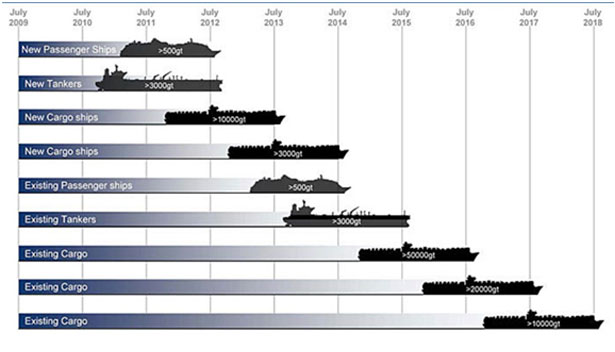
By decision of the International Maritime Organization (IMO), ECDIS, powered by ENCs, will replace printed nautical charts in SOLAS vessel categories in accordance with the following time schedule:
Greek ENCs are made available in the market via the Regional ENC Coordinating Center IC-ENC and its VARs (Value Added Resellers) and distribution network.
The Hellenic Navy Hydrographic Service makes available free of charge the following sets of geospatial data. Anyone wishing to receive them must fill in the respective form.
3. Sea Level Statistics from the Greek Tide Gauge Network
4. Four Electronic Navigational Charts in S-57 format (not for navigational use)
5. National Gazetteer of Geograhical Names (link to HMGS site)
![]()
HNHS produces Paper Nautical Charts (ΧΕΕ), which are in line with IMO’s Safety of Life at Sea (SOLAS) provisions and with IHO’s S-4 standard.
HNHS’s paper charts are suitable for both professional use (by vessels not required to use ECDIS), and recreational shipping (leisure boats).
The Greek Paper Nautical Charts folio includes a total of 184 charts in various scales which cover the entire Greek territory.
HNHS updates monthly the charts it publishes by issuing the Notices to Mariners (NtM) publication.
The Greek Paper Nautical Charts are sold by HNHS’s selling points and collaborating bookstores and nautical gear stores. They can also be ordered via the e-shop.
![]()
Catalogue of Nautical Charts & Nautical Publications
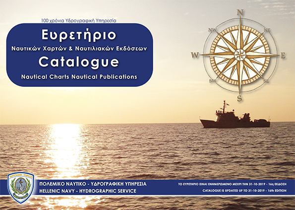
The aim of the catalogue is to provide information to the mariners and to all those who navigate the Greek seas about the Nautical charts and Publications of the Hellenic Navy Hydrographic Service
List of Lights of Hellenic coasts
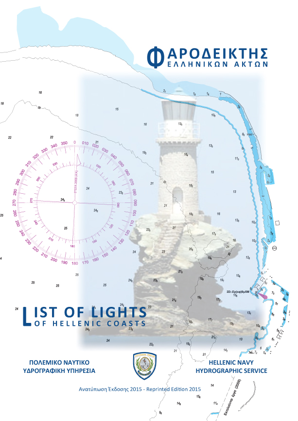
The List of Lights is published in cooperation with the Hellenic Navy Lighthouse Authority and includes information lighthouses, lights and floating lights of the Greek coasts.
The revised edition of the List of Lights is based on regulations of the International Hydrographic Organization and the International Association of Lighthouse Authority.
Notices to Mariners (monthly edition)
The HNHS Notices to Mariners (NtM) monthly edition includes all the newest information regarding the:
- New nautical charts and nautical publications.
- Correction of nautical charts
- Correction of List of Lights
- Correction of Sailing Directions (Ploigos)
- Correction of the rest of HNHS nautical publications
Permanent Notices to Mariners (annual edition)
Notices to Mariners give important information on a permanent basis, concerning the Hellenic sea area and the most important shipping lines of the Mediterranean, and, due to their importance, are repeated annually.
Copies of these Notices to Mariners, are provided to free of charge, from the HNHS selling points.
Sailing Directions of Hellenic coasts (Greek Edition)
Sailing Directions (Ploigos) is an indispensable supplement of nautical charts. Ploigos, gives detailed descriptions of coasts, dangers and ports. In addition, it gives detailed instructions about sailing into bays, ports, straits and channels and all the information needed for a safe trip.
There are 4 volumes of Sailing Directions available in Greek language which are kept updated through relative amendments.
Sailing Directions of Hellenic coasts (English Edition)
Sailing Directions (Ploigos) is an indispensable supplement of nautical charts. Ploigos, gives detailed descriptions of coasts, dangers and ports. In addition, it gives detailed instructions about sailing into bays, ports, straits and channels and all the information needed for a safe trip.
There are 3 volumes of Sailing Directions available in English language which are kept updated through relative amendments.
Sailing Directions of Hellenic coasts (amendments)
 Amendments of the above mentioned Sailing Directions publications.
XEE 64 (INT1 Hellenic version)

XEE 64 contains Symbols, Abbreviations and Terms used in HNHS Paper Nautical Charts. It is based upon the Chart Specifications of the International Hydrographic Organization.
Sea Level Statistics

HNHS Sea Level CD includes statistical sea level data derived from a long-term recording process monitored by HNHS tide gauge network.
Available only in digital form and in Greek language
![]()
The Hellenic Navy Hydrographic Service (HNHS) was firstly organized as a Hydrographic Office of the Hellenic Navy, in 1905.
Since then, the HNHS continues to provide its products and services to the mariners sailing the Greek Seas.
The HNHS timeless value and offer to the Hellenic naval history is being "printed" on its products, especially the Hellenic Navy nautical charts.
Our hydrographic history is part of our naval tradition as a nation.
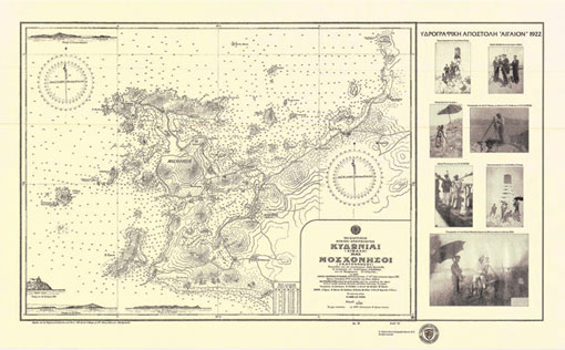
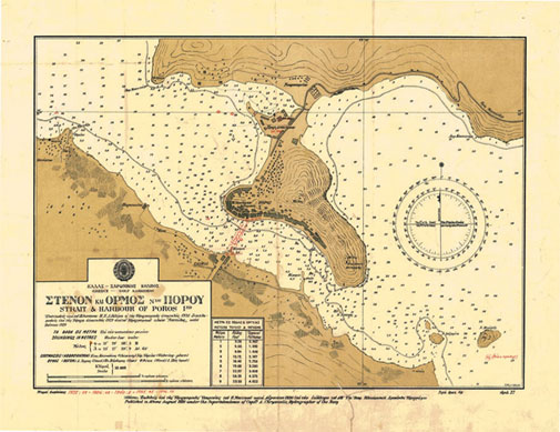
The Historical Collection of the HNHS Nautical Charts, consists of a reproduction set of the original charts, published in limited number.
The charts are available from HNHS selling points and the e-shop.
The selection will be enriched with more historical reprints in due course.
Adjusting altimetric sea surface height observations in coastal regions. Case study in the Greek Seas.
Ioannis Mintourakis
I. Mintourakis: School of Rural and Surveying Engineering, National Technical University of Athens, Zografou,15780, Greece, E-mail: mintioan@survey.ntua.gr
When processing satellite altimetry data for Mean Sea Surface (MSS) modelling in coastal environments many problems arise. The degradation of the accuracy of the Sea Surface Height (SSH) observations close to the coastline and the usually irregular pattern and variability of the sea surface topography are the two dominant factors which have to be addressed. In the present paper, we study the statistical behavior of the SSH observations in relation to the range from the coastline for many satellite altimetry missions and we make an effort to minimize the effects of the ocean variability. Based on the above concepts we present a process strategy for the homogenization of multi satellite altimetry data that takes advantage of weighted SSH observations and applies high degree polynomials for the adjustment and their unification at acommon epoch. At each step we present the contribution of each concept to MSS modelling and then we develop a MSS, a marine geoid model and a grid of gravity Free Air Anomalies (FAA) for the area under study. Finally, we evaluate the accuracy of the resulting models by comparison sto state of the art global models and other available data such as GPS/leveling points, marine GPS SSH’s and marine gravity FAA’s, in order to investigate any progress achieved by the presented strategy.
Read the paper HERE
_______________________________________________________________________________________________________________________
Evaluation of ocean circulation models in the computation of the mean dynamic topography for geodetic applications. Case study in the Greek seas
I. Mintourakis*, G. Panou, and D. Paradissis
I. Mintourakis: School of Rural and Surveying Engineering, National Technical University of Athens, Zografou,15780, Greece, E-mail: mintioan@survey.ntua.gr
G. Panou, D. Paradissis: School of Rural and Surveying Engineering,National Technical University of Athens, Zografou, 15780, Greece
Precise knowledge of the oceanic Mean Dynamic Precise knowledge of the oceanic Mean DynamicTopography (MDT) is crucial for a number of geodetic applications, such as vertical datum unification and marine geoid modelling. The lack of gravity surveys over many regionsof the Greek seas and the incapacity of the spaceborne gradiometry/gravity missions to resolve the small and medium wavelengths of the geoid led to the investigation of the oceanographic approach for computing the MDT. We compute two new regional MDT surfaces after averaging, for given epochs, the periodic gridded solutions of the Dynamic Ocean Topography (DOT) provided by two ocean circulation models. These newly developed regional MDT surfaces are compared to three state-of-the artmodels, which represent the oceanographic, the geodetic and the mixed oceanographic/geodetic approaches in the implementation of the MDT, respectively. Based on these comparisons, we discuss the differences between the three approaches for the case study area and we present some valuable findings regarding the computation of the regional MDT. Furthermore, in order to have an estimate of the precision of the oceanographic approach, we apply extensive evaluation tests on the ability of the two regional ocean circulation models to track the sea level variations by comparing their solutions to tide gauge records and satellite altimetry Sea Level Anomalies (SLA) data. The overall findings support the claim that, for the computation of the MDT surface due to the lack of geodetic data and to limitations of the Global Geopotential Models(GGMs) in the case study area, the oceanographic approach is preferable over the geodetic or the mixed oceanographic/geodetic approaches.
Read the paper HERE
_______________________________________________________________________________________________________________________
Comparison Between GPS Sea Surface Heights, MSS Models Comparison Between GPS Sea Surface Heights, MSS Models and Satellite Altimetry Data in the Aegean Sea. Implications for Local Geoid Improvement
I.Mintourakis and D. Delikaraoglou
I. Mintourakis
Department of Surveying Engineering,
National Technica lUniversity of Athens,
Zografos 15780, Greece
E-mail: mintioan@survey.ntua.gr
We have conducted various experiments of sea surface height (SSH) measurements in Greece’s Aegean Sea using on-board kinematic GPS recordings and the KMSS04 satellite altimetry-derived mean sea surface for comparison. This region is of particularinterest because of strong crustal movements due to intense tectonic activity that create significant local geoid variations. In this paper, we report on the results of separate SSH surveys that were conducted in three test areas in the Aegean Sea. Ship borne GPS data were collected together with GPS data simultaneously collected at nearby mainland reference stations. These high rate data were processed in kinematic mode using scientific GPS software and related to SSH observations, thus allowing us to obtain maps of the instantaneous sea surface, which was estimated with a precision at the level of a few centimeters. Tidal recordings from nearby tidal stations provided us with the required tidal corrections for the reduction of the GPS-derived SSHs to mean sea level (MSL). Following a filtering process, a cross over adjustment and gridding of the pointwise SSH observations in each test area, local maps of the mean sea surface(MSS) were obtained, which can be compared with the available KMSS04 global solution for the MSS. To examine further the MSS-related results that we observed in these experiments, we compared both the GPS-derived and the KMSS04-related MSS with JASON-1 radar altimetry and ICEsat laser altimetry data over the same areas. We show that the SSHs derived from the GPS ship surveys, when carefully analyzed and applying suitable filtering techniques and necessary corrections for the Dynamic Ocean Topography (DOT) can provide enhanced shorter wavelength components of the local geoid. This is illustrated with additional comparisons with the EGM96 and EGM08 global geoid models, in order to reveal any significant differences, mainly in the short wavelength domain, when compared to the aforementioned local geoid models computed from purely GPS-derived SSH data.
Read the paper HERE
_______________________________________________________________________________________________________________________
Underwater sound speed Netcdf calculator
Petros Bitsikokos (a), Ioannis Bitsikokos (b)
(a) Military oceanographer (OF-1), Hellenic Navy Hydrographic Service, 229 Av. Mesogeion TGN 1040, Cholargos, pmpitsikokos@gmail.com;
(b) Software Engineer, independent researcher, 14 Agnoston Martiron st. Nea Smirni, Athens Greece, jmpitsikokos@gmail.com
The paper describes and presents preliminary results of a Netcdf Transformer tool, developed under java environment, for calculating and producing underwater Sound Speed Netcdf files. This study has been conducted using E.U. Copernicus Marine Service Information (CMEMS). By combining distinct Salinity and Temperature Netcdf data output from CMEMS, a compatible with low end machines Netcdf calculator is created, suitable for “at sea” calculations of the underwater sound speed. The calculations performed are based on Mackenzie (1981) 9 term formula for underwater sound speed. Products of the calculator are depicted in results. The soundscape / acoustic environment of the area bounded by 36N to 42N and Prime Meridian to 009E is calculated, with the distinct halo-clinic fronts of the area in mind. As input data, monthly mean hind casted average salinity and temperature data are selected for a period of 12 months. The calculator input data are the salinity and temperature Netcdf data outputs of Mediterranean Sea physical reanalysis component (product MEDSEA_REANALYSIS_PHYS_006_004), as made available by CMEMS. The output is a single Netcdf sound speed data file, plotted using NASA’s Panoply software. The use of the calculator, permits the production of Military Oceanography (MILOC) related products, thus allowing the comprehensive and robust identification of the soundscape, therefore directly enhances the Environmental Knowledge and Operational Effectiveness (EKOE) principle for all level commands.
Read the paper HERE
See relevant poster HERE
_______________________________________________________________________________________________________________________
Validation Of Operational Ocean Circulation Forecast Models of the Aegean Sea
by Panourgias Siderakos
A dissertation submitted in partial fulfilment of the requirements for the degree of M.Sc. (Oceanography) by instructional course
FACULTY OF NATURAL AND ENVIRONMENTAL SCIENCES
OCEAN AND EARTH SCIENCE, UNIVERSITY OF SOUTHAMPTON
From the ancient years till present, the Aegean Sea has always been a sea with major importance. From famous ancient ship battles to modern trading, it always played an essential role for the whole world. Nowadays, all the above combined with its unique oceanographic conditions and topography, the Aegean Sea has become the field of development for two operational, ocean circulation forecast models, the ALERMO model and the POSEIDON model. In this project, an effort for the validation of both models was originally targeted. However, due to lack of data from the POSEIDON model, the validation was performed only for the ALERMO model. Two months were initially chosen, one in winter and one in summer in order to compare their errors based on the different season. As a result, every forecast of the model was being examined in both resolutions of the model (1/30⁰ and 1/60⁰) for both months. Detailed figures of the forecasts are given, in both months and both resolutions in order for the reader to understand the differences that the model demonstrates in relation to the season. In addition, the Root Mean Square Error is calculated and given for each different case. Finally, from in-situ CTD measurements that took place in the Aegean Sea during 2014 and 2016 from an oceanographic ship of the Greek Navy, vertical temperature and salinity profiles were made in relation to depth in order to see the performance of the model in the water column generally. The most important conclusion of this research project is that the model performs very well with specific defects. Each season has its own defects and the model has permanent errors in specific areas in the Aegean. These areas are the mouth of the Dardanelles Strait and the waters adjacent to the coastline of Greece’s mainland. A significant part of these errors happen probably because of the fact that ALERMO is one-way nested to a larger model that covers the whole Mediterranean Sea and has quite low resolution (1/16⁰). Nevertheless, the development of the model is continuous and the improvements are visible both in its function and its errors. A research with salinity data would be very useful and interesting in the future, as today the daily and monthly data for this region are very poor.
Read the dissertation HERE
_______________________________________________________________________________________________________________________
ALB Effectiveness in the Aegean Sea
Lt Georgios Georgopoulos,
Hellenic Navy Hydrographic Service,
Greece
Function of Water Clarity 29/05/2015
An Airborne Lidar Bathymetry (ALB) system has to cope with a number of limitations. Weather conditions (rainfall, humidity and sea state), together with bottom conditions (slope of the seabed, material type, roughness and density) are of great importance. However, the factor that dominates is water clarity. The attenuation of a beam of light by water results from two independent mechanisms; scattering and absorption. Therefore, turbidity, which is controlled by rivers’ runoffs and winds, wind/wave induced sediment re-suspension, the intensity of coastal human activity, the tidal amplitude and the structure of the water column itself, have the potential to significantly influence the maximum surveyable depth.
Read the article HERE


