hhypiresia
The Hellenic Navy Hydrographic Service informs mariners that:
1. The Amendment 6 / 2015 to the Saling Directions of the Hellenic Coasts (Volume B, greek language), has been printed, published and is in sale in both the Sales Points and the E-shop.
2. The above amendment contains the Notices to Mariners issued from the 2004 edition of the Saling Directions of the Hellenic Coasts (Volume B, greek language) up to NM 75 / 2015 (volume 4 / 2015)
SARONIKOS GULF. SALAMINA ISLAND. SALAMINA BAY. MOORING BUOY LIGHT:
37 56 02N - 023 26 22E
UNLIT

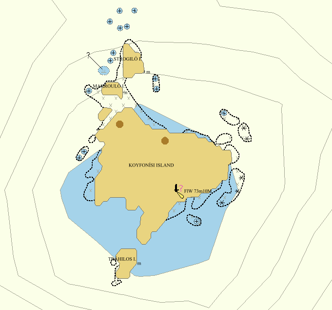
The Hellenic Navy Hydrographic Service (HNHS) compiles Additional Military Layers (AMLs) to support the Hellenic Navy operational needs.
AML (Additional Military Layers) is a NATO standard ratified under STANAG 7170 and is defined as:
“...a unified range of digital geospatial data products designed to satisfy the totality of NATO non navigational maritime defense requirements’’
AMLs are sets of geospatial data products for the publication and exchange of all types of:
- Hydrographic information beyond that necessary solely for maritime navigation as defined by International Convention for the Safety of Life at Sea (SOLAS), 1974, Chapter V.
- Oceanographic climatological information
- Meteorological climatological information
The basic AML layers produced by HNHS are:
Vector:
- CLB (Contour Line Bathymetry)
- ESB (Environment, Seabed and Beach)
- LBO (Large Bottom Objects)
- MFF (Maritime Foundation and Facilities)
- RAL (Routes, Areas and Limits)
- SBO (Small Bottom Objects

Η Υδρογραφική Υπηρεσία (ΥΥ) κατασκευάζει Επιπρόσθετα Θεματικά Επίπεδα (AMLs) για την υποστήριξη των επιχειρησιακών αναγκών του Πολεμικού Ναυτικού.
Τα AMLs (Additional Military Layers) είναι ένα πρότυπο του NATO που επικυρώθηκε στο πλαίσιο της STANAG 7170 και έχει ορισθεί ως:
“…μια ενιαία σειρά προϊόντων γεωχωρικών δεδομένων, που έχουν σχεδιαστεί για να καλύψουν το σύνολο των μη ναυτιλιακών απαιτήσεων θαλασσίου περιβάλλοντος του NATO”
Τα AMLs είναι σύνολα γεωχωρικών δεδομένων για την έκδοση και ανταλλαγή των παρακάτω τύπων πληροφοριών:
- Υδρογραφικές πληροφορίες πέραν αυτών που απαιτούνται για τη ναυτιλία και προσδιορίζονται από τη συνθήκη για την Ασφάλεια της Ζωής στη Θάλασσα (SOLAS).
- Ωκεανογραφικών και Κλιματολογικών πληροφοριών.
- Μετεωρολογικών και Κλιματολογικών πληροφοριών.
Τα βασικά θεματικά επίπεδα AMLs που κατασκευάζει η ΥΥ είναι:
Διανυσματικά:
- CLB (Contour Line Bathymetry)
- ESB (Environment, Seabed and Beach)
- LBO (Large Bottom Objects)
- MFF (Maritime Foundation and Facilities)
- RAL (Routes, Areas and Limits)
- SBO (Small Bottom Objects)
Piraeus Shop
(66 Moutsopoulou Coast, Piraeus, Tel - Fax: +30 2104583632)
E-Mail: pir.store@hnhs.gr


