

hhypiresia
In addition to Notices to Mariners, the Hellenic Navy Hydrographic Service (HNHS), also issues urgent information entitled ‘’HELLENIC NAVWARNS’’, which concern information about the safety of navigation.
For Navwarns main theme, please see paragraph 7.1 of Annual Notice Νο.13.
Navwarns do not replace the notice issued by HNHS or other navigational aids.
Navwarns are numbered throughout each year, by a serial number starting from 1, this number to be followed by the year of issuance (i.e. 1073/1999).
Navwarns are eliminated:
- Automatically (when they have a specified duration)
- By another Navwarn
- By a relative Notice to Mariner (in which the initial information of the Navwarn is included more fully and extensively), so the Navwarn continues to be transmitted for 15 days from the issuance of the Notice that repeals it, because it is estimated that within this time frame the diffusion of the Notice will have been concluded.
Navwarns are not printed and are not distributed as Notices to Mariners do, but, due to the emergency of situation, are been transmitted via Radiotelephony as follows:
- J3E type of transmission in Greek and English language by the following shore stations in areas as follows:
‘‘KERKYRA RADIO’’ (39o 36’ 25,7’’ – 19o 53’ 28,4’’) from the Ionian Sea until the meridian 22o 30’ 00’’ towards east (Patraikos and Corinthiakos bays included)
‘‘IRAKLEIO RADIO’’ (35o 19’ 19,7’’ – 25o 44’ 54,9’’) and ‘‘LIMNOS RADIO’’ (39o 54’ 24,7’’ – 25o 10’ 50,6’’) for the Aegean Sea between parallels: 34o 00’ 00’’ – 41o 00’ 00’’ and meridians 22o 30’ 00’’ – 30o 00’ 00’’.
‘‘RODOS RADIO’’ (36o 24’ 31,2’’ – 28o 13’ 37,1’’) for the South Aegean Sea between parallels: 34o 00’ 00’’ – 38o 00’ 00’’ and meridians 22o 30’ 00’’ – 30o 00’ 00’’.
The shore stations KERKYRA RADIO and LIMNOS RADIO are also transmitting the summary table of Hellenic Navwarns which are valid for the Greek seas.
Note: The call sign, the frequency, the time and type of emission and other attributes of the above stations, as well as information concerning the broadcasting of ‘‘Weather Report” and “Press Release” are provided in detail in the table of frequencies which is attached at the end of the document.
2. G2B / G3E type of transmission in Greek and English language for the Greek seas, by the following VHF transmitters of “OLYMPIA RADIO” Emitting Station
| Router | Position | Transmission channel |
Power (WATT) |
Navwarns Transmission hours UTC |
Navwarns Transmission hours UTC |
| KERKYRA | 39 44 54 - 019 52 20 | 02 | 50 | For the area of the Eastern Mediterranean and the Black Sea 06:00 10:00 16:00 22:00 |
|
| KEFALLINIA | 38 08 28 - 020 39 31 | 27 | 50 | ||
| PATRA | 38 14 47 - 021 46 07 | 85 | 50 | NO | |
| PETALIDI | 36 55 45 - 021 51 32 | 83 | 50 | ||
| KYTHIRA | 36 15 57 - 023 02 50 | 85 | 50 | ||
| MOUSTAKO, CRETE | 35 18 28 - 023 36 35 | 04 | 50 | NO | |
| KNOSSOS, CRETE | 35 16 52 - 024 56 08 | 83 | 50 | 05:00 11:00 17:30 |
|
| SITEIA, CRETE | 35 04 14 - 026 11 32 | 85 | 50 | ||
| RODOS | 36 16 22 - 027 56 01 | 63 | 50 | ||
| SYROS | 37 27 27 - 024 55 37 | 04 | 25 | 23:30 | |
| PARNITHA | 38 10 16 - 023 43 39 | 25 | 50 | ||
| PILION | 39 24 16 - 023 03 07 | 60 | 50 | ||
| CHIOS | 38 22 34 - 026 02 44 | 85 | 50 | NO | |
| MYTILINI | 39 04 22 - 026 21 15 | 01 | 50 | ||
| LIMNOS | 39 54 14 - 025 04 39 | 82 | 50 | ||
| SFEDAMI, PIERIA | 40 25 09 - 022 31 06 | 23 | 50 | ||
| ASTYPALAIA | 36 35 59-026 26 26 | 23 | 50 | NO | |
| THASOS | 40 43 51 - 024 39 43 | 85 | 50 | ||
| FAISTOS | 34 59 37 - 025 12 25 | 27 | 50 |
Note:
a. The aforementioned emissions are pre-announced in the international distress channel 16 for VHF and with a DSC (SAFETY) call frequency 2187,5 for MF.
b. If Navwarns are issued that require immediate transmission, they are transmitted from the working channels of the areas concerned, firstly by digital selection call (DSC) in channel 70, followed by a Navwarn in the international distress channel 16 for VHF and with a DSC (SAFETY) call in frequency 2187,5 for MF.
The above paragraph’ s stations transmit daily, at the above hours, in Greek and English language, the number Navwarns for Mariners (HELLENIC NAVWARNS) as well as the “table of valid Navwarns”. Which is issued daily by HNHS. Also, the above stations received and retransmit ship information relative to the Safety of Navigation.
The full text of a Navwarn that is not transmitted, a summary of which is included in the “table of valid Navwarns”, can be requested from the aforementioned stations by any interested Mariner.
The local port authorities provide, during permission grant for sailing (CLEARANCE), the last “table of valid Navwarns”, where every number of valid Navwarn is indicated, its subject and the area which is referred to (in summary), so as the Captain right after sailing to be ask via R/T the shore stations for the full text of the Navwarn that is interesting for his voyage.
On the occasion where HNHS considers necessary the wider dissemination of a Navwarn, they forward it as NAVHELLEN to coordinator NAVAREA III(SPAIN), which has been appointed as the responsible for Navwarns dissemination for the entire Mediterranean – Black Sea area.
Detailed information about areas and their coordinators, stations, frequencies and emission hours of NAVAREA Navwarns, are provided in Notice #13 of each year, as well as in the ADMIRALTY LIST OF RADIO SIGNALS NP 283(1) of the British Admiralty.
For valid Navwarns, please press here.
The Hellenic Navy Hydrographic Service makes available free of charge the following sets of geospatial data. Anyone wishing to receive them must fill in the respective form.
3. Sea Level Statistics from the Greek Tide Gauge Network
4. Four Electronic Navigational Charts in S-57 format (not for navigational use)
5. National Gazetteer of Geograhical Names (link to HMGS site)
![]()
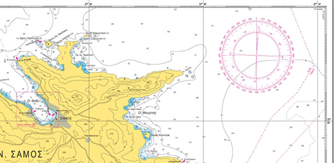
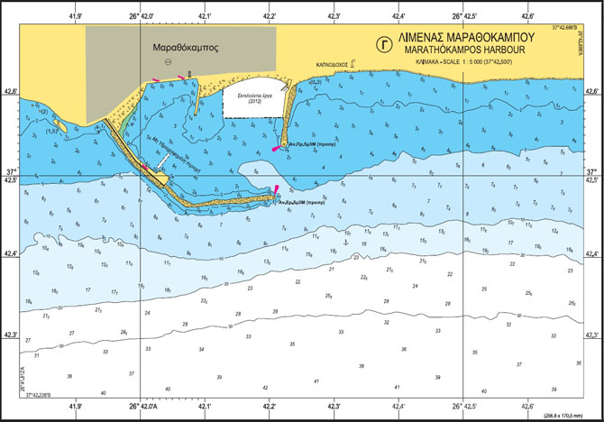
HNHS produces Paper Nautical Charts (ΧΕΕ), which are in line with IMO’s Safety of Life at Sea (SOLAS) provisions and with IHO’s S-4 standard.
HNHS’s paper charts are suitable for both professional use (by vessels not required to use ECDIS), and recreational shipping (leisure boats).
The Greek Paper Nautical Charts folio includes a total of 184 charts in various scales which cover the entire Greek territory.
HNHS updates monthly the charts it publishes by issuing the Notices to Mariners (NtM) publication.
The Greek Paper Nautical Charts are sold by HNHS’s selling points and collaborating bookstores and nautical gear stores. They can also be ordered via the e-shop.
![]()
Catalogue of Nautical Charts & Nautical Publications
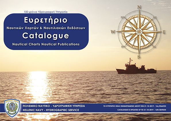
The aim of the catalogue is to provide information to the mariners and to all those who navigate the Greek seas about the Nautical charts and Publications of the Hellenic Navy Hydrographic Service
List of Lights of Hellenic coasts
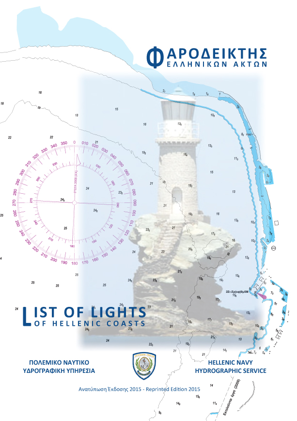
The List of Lights is published in cooperation with the Hellenic Navy Lighthouse Authority and includes information lighthouses, lights and floating lights of the Greek coasts.
The revised edition of the List of Lights is based on regulations of the International Hydrographic Organization and the International Association of Lighthouse Authority.
Notices to Mariners (monthly edition)
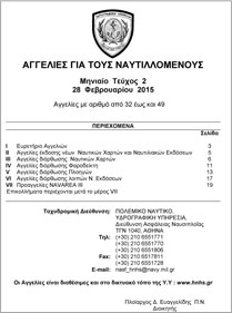
The HNHS Notices to Mariners (NtM) monthly edition includes all the newest information regarding the:
- New nautical charts and nautical publications.
- Correction of nautical charts
- Correction of List of Lights
- Correction of Sailing Directions (Ploigos)
- Correction of the rest of HNHS nautical publications
Permanent Notices to Mariners (annual edition)
Notices to Mariners give important information on a permanent basis, concerning the Hellenic sea area and the most important shipping lines of the Mediterranean, and, due to their importance, are repeated annually.
Copies of these Notices to Mariners, are provided to free of charge, from the HNHS selling points.
Sailing Directions of Hellenic coasts (Greek Edition)
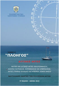
Sailing Directions (Ploigos) is an indispensable supplement of nautical charts. Ploigos, gives detailed descriptions of coasts, dangers and ports. In addition, it gives detailed instructions about sailing into bays, ports, straits and channels and all the information needed for a safe trip.
There are 4 volumes of Sailing Directions available in Greek language which are kept updated through relative amendments.
Sailing Directions of Hellenic coasts (English Edition)
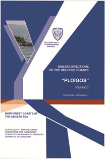
Sailing Directions (Ploigos) is an indispensable supplement of nautical charts. Ploigos, gives detailed descriptions of coasts, dangers and ports. In addition, it gives detailed instructions about sailing into bays, ports, straits and channels and all the information needed for a safe trip.
There are 3 volumes of Sailing Directions available in English language which are kept updated through relative amendments.
Sailing Directions of Hellenic coasts (amendments)
 Amendments of the above mentioned Sailing Directions publications.
XEE 64 (INT1 Hellenic version)

XEE 64 contains Symbols, Abbreviations and Terms used in HNHS Paper Nautical Charts. It is based upon the Chart Specifications of the International Hydrographic Organization.
Sea Level Statistics

HNHS Sea Level CD includes statistical sea level data derived from a long-term recording process monitored by HNHS tide gauge network.
Available only in digital form and in Greek language
The printed Navigational Charts and Nautical Publications of the Hydrographic Service are available at:
a. E-Shop
b. The Piraeus shop
(66 Moutsopoulou Coast, Piraeus,
Tel-FAX: +30 210-4583632,
E-Mail:pr_store@hnhs.gr)
View Map
The Division studies, proposes and implements modern IT solutions aiming to fully automate the procedures for producing and offering HS products in line with the evolving trends in Telecommunications and IT.
In this context, it supports and manages, at both software and hardware levels, computer networks that:
 Are used to transfer data.
- Ensure resource sharing.
- Interconnect the points of sale of HS products.
- Distinguish the work and services that the HS offers to citizens over the Web.
- And support uninterrupted contact with the agencies, both in Greece and abroad, with which the HS works.

The Division is responsible for:
- Issues concerning ths HNHS personnel.
- Maintaining good operational condition of the hydrographic / oceanographic vessels and vehicles.
- Monitoring and managing financial cash transactions.
- Keeping up with the annual budget.
- Advertising HNHS products.
- Checking copyright issues.
- Maintaining and upgrading the local computer equipment
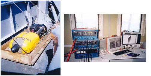
Being knowledgeable of the marine environment and how it behaves, plays an important part in the conduct of naval operations. The Hydrographic Service is in charge of planning and conducting oceanographic research to study and find out about the physical parameters and natural phenomena of the marine environment, to the benefit of the HN. It is a set of scientific works, known as Military Oceanography, implementing operational oceanography, with a view to supporting the units of our fleet. Oceanography Directorate is in charge of such tasks.
The instruments used include:
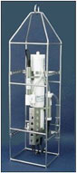
CTD instrument packages
Conductivity, Temperature, Depth (CTD) instruments are used to determine the main physical parameters of the water and the speed of sound propagation in it.
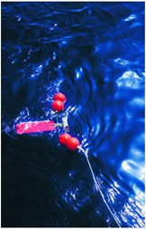
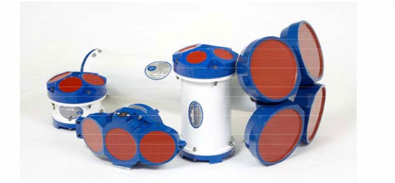
Current Meters
Mechanical and acoustic current meters are used to measure the speed and direction of currents in different regions of the Aegean and Ionian Seas at selected depths.
At the same time wave conditions prevailing in Greece’s maritime space are assessed. These forecasts are intended for use by the Ministry of Merchant Marine for the departure of certain passenger ships. They result from the use of mathematical models to estimate the wave field taking into account the speed and direction of winds in the area of interest.
The Directorate also collects bathythermographic and other observations from other ships and services of the HN. These are processed, sorted and used accordingly.
 Differents Type Acoustic Current Meter
(Side Scan Sonar)

Type 'Chirp' Sub-bottom Profiler
It determines the stratigraphy of the seabed structure to a depth of several meters, depending on the particle size distribution of sediments in the area studied.
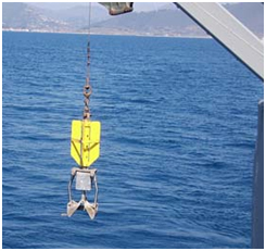 Surface Sediment Samples
It takes disturbed samples of surface sediment. Such samples are analyzed in the laboratory to sort sediments based on their particle size distribution and determine the content of carbonates in them.
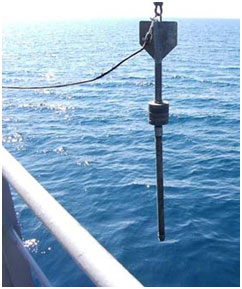
Gravity Core Sampler
It takes samples of bottom sediment cores. The undisturbed samples taken are analyzed in the laboratory to sort sediments based on their particle size distribution across the entire sampling length, as well as to determine the percentage of carbonates, the density and shear strength of core sediments.